Iran Earthquake Today: 4.3 Magnitude Hits Gerash | Latest News
A magnitude 4.3 earthquake struck the Gerash region in southern Iran’s Fars province on Tuesday, March 3, 2026. The tremor occurred at a shallow depth of approximately 10 kilometres.
Focus on the 10km depth and location near Gerash
- Magnitude: 4.3
- Time: Approximately 12:24 PM local time (06:54 UTC)
- Epicentre: Roughly 52–55 km northwest of Gerash city, Fars province
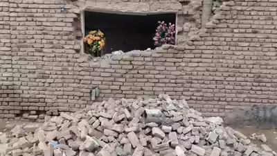
- Impact: No immediate reports of casualties or significant structural damage have been confirmed.
- Geological Context: The quake originated in the Zagros fold-and-thrust belt, a seismically active zone where the Arabian and Eurasian tectonic plates converge.
Current Situation and Speculation
The earthquake occurred during a period of high regional tension, including reported US and Israeli military strikes. This timing led to widespread social media speculation regarding a potential covert nuclear test.
Seismologists from the Comprehensive Nuclear-Test-Ban Treaty Organization (CTBTO) and the Berkeley Seismology Lab noted that the event’s seismic “fingerprint” and 10 km depth are consistent with natural tectonic activity rather than an artificial explosion.
The UN’s nuclear watchdog (IAEA) indicated no evidence of damage to known nuclear installations, such as Natanz or Bushehr.